
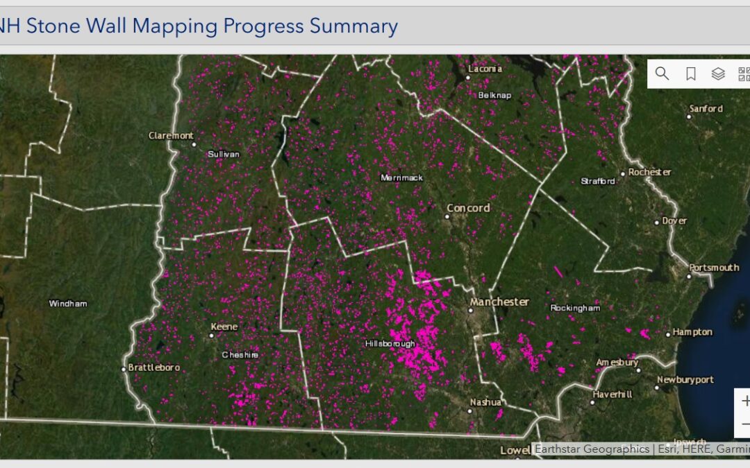
The print dots/lines show “mapped” stone walls as of Sept. 2021. https://www.granit.unh.edu/resourcelibrary/specialtopics/stonewalls/
The NH Geological Survey has an interesting online project called the Stone Wall Mapper that wants to map all the tens of thousands of miles of stone walls in the state. But the project doesn’t involve crawling around with a GPS – it finds walls on LIDAR mapping of the state. You go to the map and poke around, finding what you’re pretty sure are stone walls (they’re quite distinctive) and then mark them digitally. Right now 16,000 miles of walls – almost 211,000 of them – have been marked. Almost none have been double-checked on the ground, however.
I’ve written about it before – including this item in 2019 asking why the pattern of stone walls differed around the state.
The state is offering online training if you want to get involved. They recommend looking through the “Wall to Wall: Connecting Landscape and Culture” storymap first: https://granit.unh.edu/resource…/specialtopics/stonewalls/The first training session will be Monday October 4 from 6:30-8pm on Zoom, although you have to register beforehand: https://extension.unh.edu/…/nh-stone-wall-mapper…
Comments are closed.